

By John Goraj
Guest Contributor
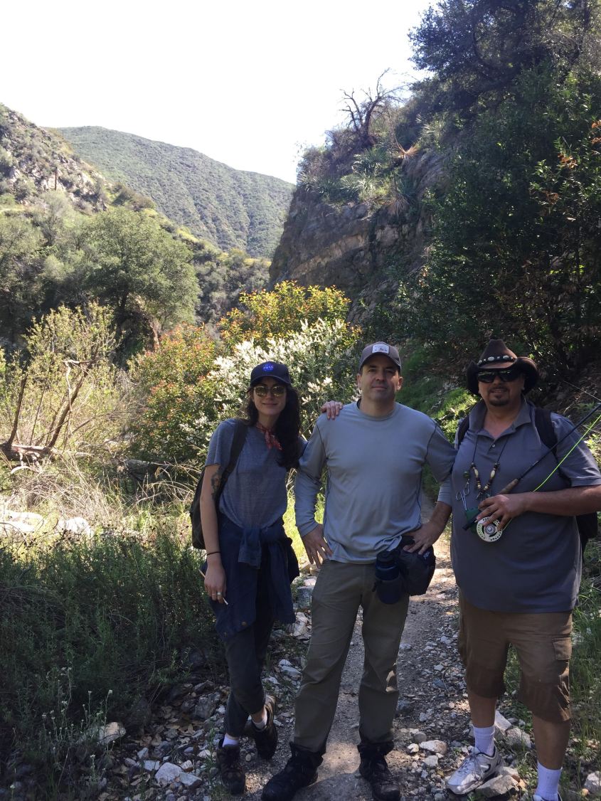
Myself, along with three other volunteers, began the scout at the Altadena Crest Trailhead in Altadena. We hiked for about two and a half miles on the Gabrieleno Trail along the Arroyo Seco to Gould Mesa Trail Camp, eventually turning around somewhere between Gould Mesa and Paul Little Picnic Area. The Arroyo is beautiful right now and as always, a very thriving ecosystem. We saw several California newts, who are mating right now and mountain yellow-legged frogs.
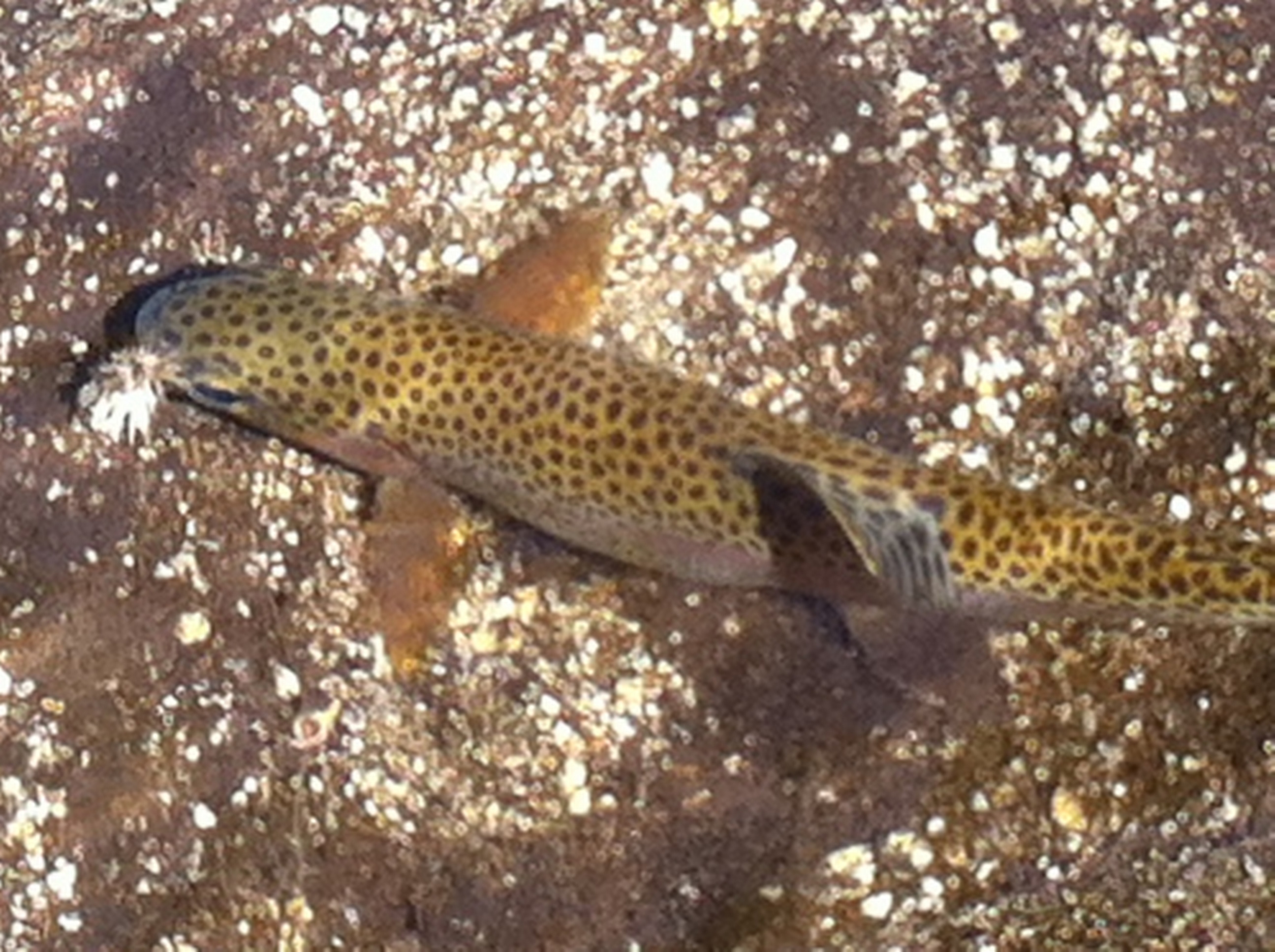
We stopped several times along the way making several notes about trout habitat and riverine conditions. We saw several things that made me confident of the existence of rainbow trout in the Arroyo. Here are some of the major habitat features that we discovered in several key habitat categories.
This central section of the stream currently possesses all of the necessary habitat requirements needed for native southern California trout to thrive; cool and clear water, stable undercut banks, clean gravel beds with little to no silt, overhanging vegetation, structural/habitat diversity and the food that trout eat.
The stream is flowing well about 5-10 cfs and the water temperature is cool. The banks along this section of the stream are undercut creating sufficient pool depth for trout to live in during the drier summer months.
Additionally, the roots of white alder trees which grow abundantly along the stream provide strong support along the banks. The gravel beds are clean and soft creating high quality habitat for trout to possibly spawn in the future. Canopy cover above the stream (overhanging vegetation) was almost always 50-to-75 percent, which keeps dissolved oxygen adequately high for native trout to thrive.
Lastly, many of the key components of trout dietary needs were present as well. These include terrestrial insects, spiders, midges, dragonflies and water boatman bugs.
Perhaps the most promising feature was the discovery of several two-to-four-foot-deep pools created by in-stream structural diversity, such as boulders and large woody debris. These pools are essential for trout survival and illustrate the important function that downed logs and boulders play in providing high quality for trout.
I will keep you all updated on the next “Trout Scout” and any possible trout sightings!
John Goraj is the Native Trout Program Manager at the Arroyo Seco Foundation.

By Rosi Dagit
Guest Contributor
She was lying on her back on the bottom of a pool, pushed by the flow against a rock. Bruised, scales falling off, scrapes all over her body, she was barely breathing. Gently holding her face into the flow, she gasped for air and hung limply in my hands. I could feel her muscles twitch and contract, but she could not swim at all. When I let her go, she sank to the bottom on her back and rolled with the flow on her side, up against my feet, unable to orient herself.
At 23 inches, she was a full-grown anadromous steelhead that had fought her way upstream against the current in search of a place to spawn. The creek was wondrous after all the winter storms, with steady flows cascading over rocks, providing a background music calling her upstream to find a good place to lay her eggs.
For several minutes we stood and discussed what to do. She was clearly not going to recover and survive, but she was not quite dead yet. It was just heartbreaking to think of losing this fish, one of only four anadromous adults known to have returned to the creeks so far this year in all of Southern California.
What went wrong? How did she get so banged up? Was the flow too strong? Was she too old and tired, having waited too many years for the rains to come?
She died in my hands. I brought her battered body back to teach us and help us learn to tell her story. Her scales will tell us her age. Her DNA will give us insight into her ancestry. She was not one of our tagged fish, but from somewhere else. Only 18 eggs, an empty stomach. The promise of the future for southern steelhead took a big loss today.
Rosi Dagit is a Senior Conservation Biologist for the Resource Conservation District of the Santa Monica Mountains.
Editor’s Note: Dagit and the RCDSMM have permits to monitor and handle these endangered fish. Only permitted biologists are allowed to handle them. There is a substantial fine per fish (around $25,000) for harassment or taking one from the water, if not permitted.
 Fellow anglers,
In a political time, it’s once again time to get political.
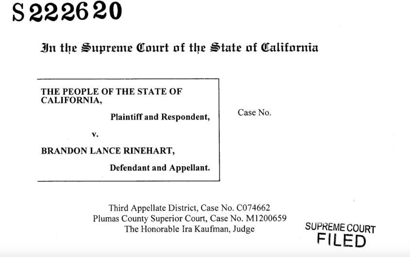
If you thought that suction dredging mining was banned for good from the East Fork of the San Gabriel River outside Los Angeles, and other once-pristine California waters, think again.
You can read my coverage from 2012. I thought it was a done deal that the California Department of Fish and Wildlife would be allowed to stop illegal activities even on federal lands, even within a national monument. But Pasadena Casting Club Conservation Chair John Tobin recently alerted me that, sadly, it might not be the case in the future.
As Tobin wrote in an email, “California Senate Bill 637, effective January 1, 2016, created a path for the statutory prohibition against suction dredge mining on our California streams to be lifted.”
Currently, there’s a case before the California Supreme Court challenging whether state environmental law that makes a particular mining claim on federal land commercially impractical preempted by the federal mining laws, according to the brief.
In other words, can California through its police power protect the environment, even on federal land?
For anglers, this means a choice between antiquated, destructive machinery disrupting the stream bed and scattering whatever trout may have thrived there for a largely recreational activity. Imagine trying to wet a line next to one of these contraptions. Imagine the downstream effect to the water.

You can lend your voice either at Trout Unlimited on suction dredging issue or at Friends of the River alert on suction dredging.
You use our national lands to enjoy one of the best parts of your recreational life. Help make suction dredge mining a thing of the past.
See you on the river, Jim Burns

By John Tobin
Guest Contributor
Less than an hour’s drive from here, up in those dry and dusty San Gabriel Mountains, are three rare and precious wild trout streams, the West, North and East forks of the San Gabriel River.
Under arbors of alder, sycamore and oak, they run clear and cold all year long, despite drought, and harbor wild rainbow trout. Some of the rainbows are direct descendants of steelhead trout, which went to and from the sea for eons before the dams were built.
The streams are also home to some threatened and endangered creatures, including the Santa Ana speckled dace, that exists only in the Los Angeles basin. These flows are always under pressure, and not just from the lack of water. They frequently suffer from overuse by crowds of visitors, some of whom trash them and others who damage them with illegal gold mining and with what the forest service calls “recreational dam building.”
The forest service has long been hard pressed to protect them: not enough money, and not enough staff.
The many people who know and love these streams were naturally excited when President Obama designated the National Monument in the fall of 2014, anticipating that plans and resources would be developed to better protect these waters. And so the fishers, the hikers and the mountain bikers, together with professional fishery experts, weighed in during the requisite public comment period to tell the forest service what they thought should be done for these streams in the new San Gabriel Mountains National Monument Plan.
At the end of that process, the forest service produced a summary of the comments and an outline of the issues and concerns they determined should be the focus of the plan. Sadly, the outline for their management plan does not include any focus on these streams.
Consequently, in accordance with the forest service’s planning policies, all of the stream-specific comments and recommendations that were submitted by the public were ignored. They will not have an influence on the management plan for the national monument.
If this concerns you, let the forest service know:
Contact Justin Seastrand, Environmental Coordinator, Angeles National Forest, at jseastrand@fs.fed.us, or Superintendent Jeffrey Vail, at JVail@fs.fed.us.
Don’t have to wait for the next public comment period later this winter or spring, when part of the environmental assessment will be published. It may be too late by then.
John Tobin is the conservation chair for the Pasadena Casting Club.

UPDATE:
I found this recent story that I saw on TV news as well as read in the L.A. Times pretty confusing. From the story:
“We’re hoping for the best, but we’re going to continue to prepare for the worst,” Los Angeles Mayor Eric Garcetti said. “… If [the river] floods, there is risk of significant damage, not to mention real and immediate danger to Angelenos.”
If you’ve been down to Glendale Narrows, you know that the river encasement is already high, 20 feet, according to the U.S. Army Corps Los Angeles River Ecosystem Restoration Feasibility Study so what could a temporary four-foot-high barrier accomplish that isn’t already there? And for $4.5 million?
But the more vexing part of this emergency solution is “removing debris.” If the Corps removes the islands and plant life that dot the area, you can kiss the only structure fish have goodbye. It’s also a very healthy bird habitat. The NBC story indicates this is already taking place. Here’s the 2013 draft redesign plan for that area:

Existing Channel Features – The existing trapezoidal channel within the sub-reach varies from grouted rock to concrete paved channel, is 310 feet wide from the top of bank and 20 feet high from the invert.
Preliminary Channel Design – As seen in Figure 4.12, ” Cross-Section 5, Los Feliz Boulevard to Glendale Freeway,” the proposed design would construct four concrete terraced planters in the left/east bank of the channel slope. The right/west bank of the trapezoidal bank would be replaced by a 22-foot-high vertical retaining wall with subdrainage under the invert slab, which would meet the existing top of bank. Two riprap toedowns would be constructed below the channel bottom and bank. The first riprap toedown would be constructed on the right/west bank and the second that would include bank protection, would be located on the left/east bank. Two 16-foot-wide asphalt concrete maintenance roads would be constructed on the land of the retaining walls on the top of bank. The existing cobble/soft bottom would be protected in place and expanded 27 feet towards the proposed right/west bank of the channel.
See you on the river, Jim Burns

“We support FoLAR taking a stance on discarded fishing line, while educating anglers who are new to fishing the L.A. River as well as the anglers who have fished the river for decades,” wrote AVNC co-chairs Torin Dunnavant and Courtney Morris in their letter of support.
Both the AVNC and O’Farrell’s office cited a trigger event for better line management, the death of a Great Blue Heron, called Fred by locals, who was caught in fishing line, seriously injured and subsequently died as marine biologists attempted to nurse him back to health.
Monofilament may seem harmless enough, but it represents both an eco-hazard as well as a possible deadly ensnarement for the wildlife so abundant on the river. According to FoLAR, birds can be attracted to the fishy smell on used line, then become hopelessly ensnared while digging for it in convention trash cans. Also, monofillament does not degrade over time leaving what amounts to an ageless hazard if not dispossed of properly.
As awareness has increased among state agencies, fishing clubs and individual anglers, these recycling tubes have become more common on streams. For example, a tube sits next to the angler survey box at the beginning of the catch and release section of the West Fork of the San Gabriel, a popular area for local flyfishers.
Each week, the tubes’ contents will be sent to the Berkley Conservation Institute in Iowa. The company, which produces conventional fishing line, recycles used line into 4-foot cubicle fish habitats it calls “Fish-Habs.” According to the company’s website, since 1990, BCI has recycled more than 9 million miles worth of fishing line. That’s enough line to fill two reels for every angler in America.
At the close of recreational zones on Labor Day, the program results will be re-evaluated to measure impact and the tubes could become a permanent fixture on the river.
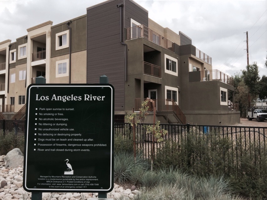
Currently, the tubes are located at the Glendale Narrows Dover Street river entrance in the yoga pocket park, Acresite Street and FoLAR’s own Frog Spot. Future rollouts include the Bowtie Parcel and Marsh Park, if the Mountains Recreation and Conservation Authority that patrols the area agrees.
Fishing has only recently become legal on the river, during a certain time — Memorial Day through Labor Day — and within certain places, the carefully defined recreational zones below Fletcher Bridge, the so-called Elysian Valley River, and in a stretch in the Sepulveda Basin River in the San Fernando Valley. The fact that the pilot line recycling tubes lie outside these boundaries speaks to the growing number of anglers who search for the best places to fish, regardless of geographic boundaries.
See you on the river, Jim Burns
UPDATE: Despite strong opposition from neighbors and recreational enthusiasts, the Los Angeles County Board of Supervisors approved a five-year project Wednesday to remove debris from a basin above Devil’s Gate Dam in Pasadena. — Los Angeles Times
Generations of fly fishers have relished the area above the Jet Propulsion Laboratory in Pasadena, which before the massive 2009 Station Fire and subsequent flood the following year, enjoyed a reputation as an enjoyable fishery. This reputation, for now at least, has certainly faded. On top of back-to-back environmental disasters, we’re in this ongoing drought. But remember, these skinny waters still contain native trout, and this region was once one of the coveted destinations for returning spawning Southern California Steelhead.
The area is important to protect, even though, for some mysterious reason, it was left out of the final draft of the San Gabriel Mountains national monument. That will be the topic of another blog post.
So today’s question: Do we need a human-made disaster on top of all of this?
Take a look at this PDF from the Arroyo Seco Foundation, the environmental voice of our conscience for this area. Anyone with a brain would want the “Pasadena Alternative” — unanimously approved by the Pasadena City Council — instead of the much more invasive one proposed by the Los Angeles County Flood Control District. As the Pasadena Star-News put it:
The City Council this week unanimously approved a set of recommendations for the county’s sediment removal plan in Devil’s Gate Dam, in its ongoing fight to prevent the treasured Hahamongna recreation area from turning into a giant ditch.
For example, the original county plan counted 400-plus trucks per work day, for five years, to haul away sediment, while the Pasadena plan calls for a quarter of that amount, an estimated 120. The county’s plan for habitat impact — a euphemism for “no more fishing” — measures more than 120 acres, while the Pasadena plan calls for 40 acres, including a 10-acre “conservation pool.” From what I read here, the county has somewhat backed off on its original proposal, but not nearly to the degree concerned homeowners want.
The final Environmental Impact Report comes before the Los Angeles County Board of Supervisors on Wednesday, as the flood control district seeks approval for its chosen alternative. According to this story La Canada city officials are scrambling to get their objections heard before it’s too late.
See you on the river, Jim Burns
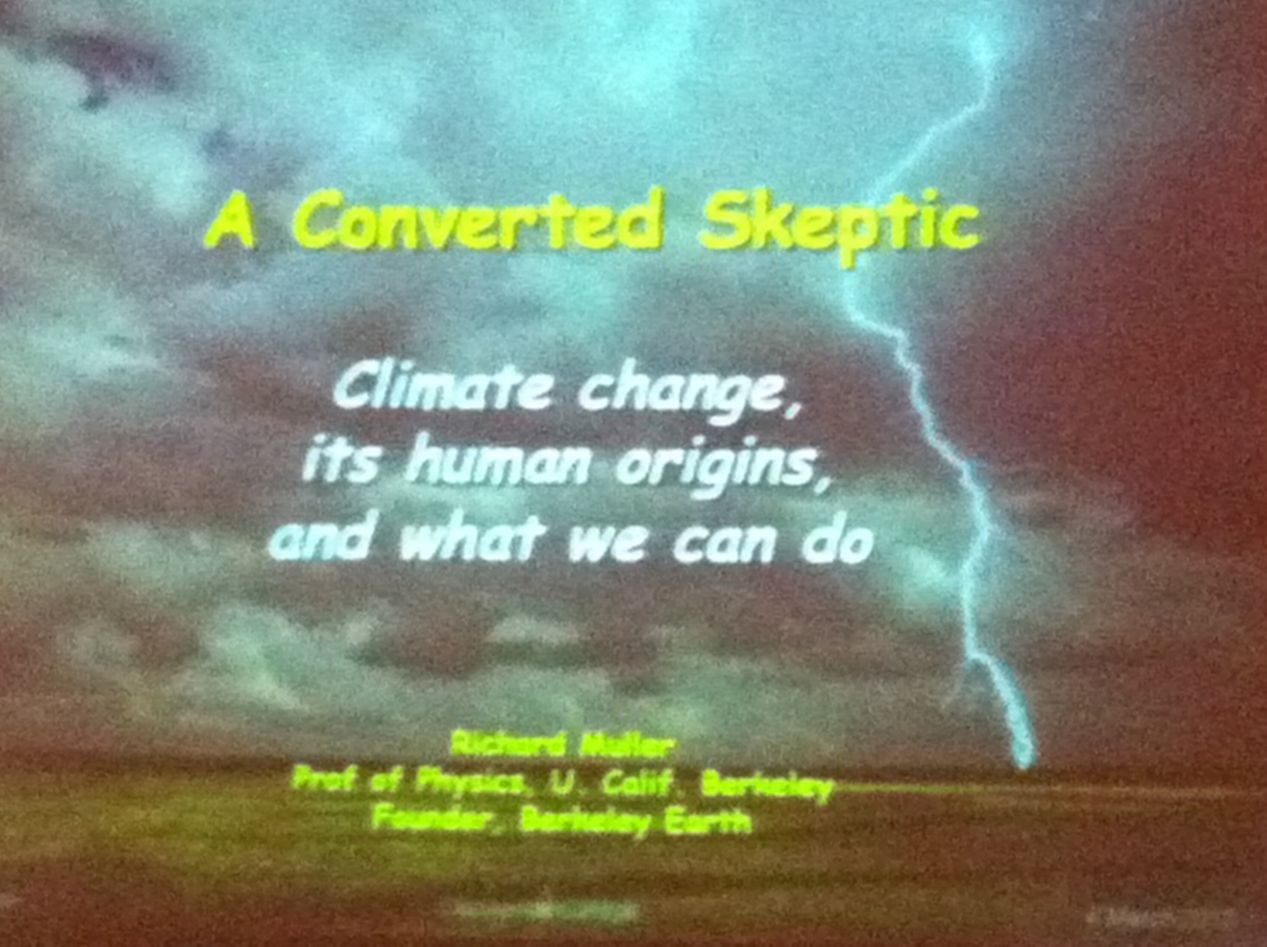
Activist physicist Richard Muller spoke at Occidental College today, explaining to a mostly student audience exactly why he became a “converted skeptic” about the human causes of global warming. In 2011, Muller testified to the U.S. House Science, Space and Technology Committee confirming an overall global warming trend, for which he later said: “Humans are almost entirely the cause.” But he also explained that his healthy initial skepticism came from reading untenable conclusions based on inadequate research.
His talk was both amusing and frightening. He repeatedly took former Vice President Al Gore to task, and reminded the audience of the little-known fact that a British judge would allow Gore to distribute his Oscar-winning documentary “An Inconvenient Truth” free to school children only if he included a list of nine errors, including that Greenland would melt, causing a massive ocean rise. Gore declined. He also reprimanded the Intergovernmental Panel on Climate Change for publishing in its fourth assessment report that the Himalayas would melt by 2030, which was not based on any science.
Muller blamed research “cherry picking,” as well as the politicizing of research contents as the culprits, and reminded the students to “remain objective.” He cited media reports as widely off the mark when it comes to global warming, saying that his own data show that there are no more hurricanes or tornadoes today than there were at the beginning of the century.
“This is something you all need to master,” he said.” How do you go about looking at a subject in a purely objective way? I would say that the thing that characterizes our civilization more than anything else was the discovery of objectivity. Remember that word and think about it.”
The professor of Physics at the University of California, Berkeley, and Faculty Senior Scientist at the Lawrence Berkeley Laboratory as well as the founder of Berkeley Earth is also the best-selling author of “Energy for Future Presidents: The Science Behind the Headlines” (2012).
On the frightening side were graphs showing rapidly increasing carbon emissions from the developing world, notably China and India. Muller, who drives a Prius, said that it did no good in solving global warming because the average citizens in those countries can’t afford to buy one. Rather, Americans should embrace affordable examples. His dual saviors were solar energy and natural gas.
Muller endorsed controversial fracking — coaxing natural gas and oil out of rocks through horizontal drilling — as the way to get China off carbon-producing coal and into cleaner natural gas. As U.S. carbon emissions slow, he said, this was the most efficient way to stop the heating up of the planet.
See you on the river, Jim Burns

The City of Los Angeles is busy presenting the proposed 2013 Los Angeles River Recreational Zone Pilot Program for Glendale Narrows with the second meeting occurring right now at City Hall. Unfortunately, I couldn’t attend, but will post when the final meeting is to occur, sometime next month. The idea is to get public comment on a plan to open up recreation within that approximately seven-mile stretch of our river.
I’ve read the pilot program and all you kayakers out there should be pretty excited. If passed, the proposal would mean that individual non-motorized boaters would be able to launch from North Atwater Park, Steelhead Park and Marsh Park, from Memorial Day through Labor Day, when there is very little chance of a flood from torrential rain. That also means you could be fly fishing from your kayak as well, because the proposal also calls for fishing, bird watching and hiking. Swimming would still be a no-no. And float tubes are just plain impractical because of low water.
Dept. of Fish and Wildlife regs would then apply in the river.
I really wonder what this would mean for the eradication of carp in the river, as the U.S. Army Corps views it as an invasive species, even though carp have been resident for decades.
From the report: On Aug. 28, 2012, Governor Brown signed Senate Bill 1201, which amended the Los Angeles Flood Control Act “to provide for public use of navigable waterways under the district’s control that are suitable for recreational and educational purposes, when these purposes are not inconsistent with the use thereof by the district for flood control and water conservation.”
Stay tuned and see you on the river, Jim Burns

The barriers are going up now on east sidea of river. I was in the north Atwater park area and they are working their way south from Colorado Blvd. They have have made it to the park. Lights were being turned on and it didnt look like they were stopping for the night. Forget about any river access in that area!